
Tokyo, Japan – Around the world, flood disasters are expected to become more frequent and more severe with climate change. But what will that mean for your local community? Detailed understanding of local risks is crucial to adapt to these changes and effectively mitigate flood hazards under a changing climate.
In a study recently published in Hydrology and Earth System Sciences, a research team from the Institute of Industrial Science, The University of Tokyo, reported the most effective approach to create future flood-hazard maps by using two different methods combined with a climate change simulation and compared the results with historical flood-hazard maps.
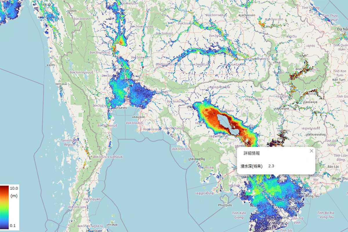
“To simulate flooding around the world, we used the Catchment-based Macro-scale Floodplain model (CaMa-Flood), an efficient model used to represent channel flow and floodplain inundation. We used runoff data to generate flood-hazard maps, downscaling simulated river water levels to 100-m resolution elevation maps,” explains lead author Yuki Kimura. The researchers then generated three types of flood-hazard maps: historical maps based on recorded runoff data, and two maps based on future flood depths. Future flood depths were estimated by two different methods: the runoff-correction method and the lookup method. They mainly differ by the data handling method and the calculation of future flood depths. The future hazard maps generated using these two methods were then compared with the historical hazard maps and with each other.
To understand the differences between the results of these two methods, the researchers selected two test cases to examine in greater detail: the basins of the Chi-Mun River, a tributary of the Mekong River in Southeast Asia, and the Amazon River in South America. The maps resulting from both methods successfully predicted increased flooding hazards in the basin of the Chi-Mun River. However, the runoff-correction method seems to have inconsistencies in the hazard in the Amazon River basin compared with climate model projections. On the basis of further analysis of the two methods and their results, the lookup method was found to be more reliable and superior to the runoff-correction method for future hazard map construction.
According to the results of the lookup method, around 1.86 billion people currently live in areas where the magnitude of flooding in the future simulation exceeded that of a flood with a 100-year return period historically. “Our risk assessment also indicated that the conventional approach using historical hazard maps instead of future simulation maps leads to underestimation of the affected population by around 200 million people globally,” says senior author of the study Dai Yamazaki.
These results highlight the importance of developing high-resolution future hazard maps to estimate local climate change risks. With the new approach and valuable data provided by the research team, high-resolution future hazard maps can be created to estimate flooding risks due to climate change more accurately, which will help us better prepare for the disasters that come along with the changing climate.
###
The article, “Methodology for constructing a flood-hazard map for a future climate,” was published in Hydrology and Earth System Science at DOI: 10.5194/hess-27-1627-2023
About Institute of Industrial Sciene, The University of Tokyo
The Institute of Industrial Science, The University of Tokyo (UTokyo-IIS) is one of the largest university-attached research institutes in Japan. UTokyo-IIS is comprised of over 120 research laboratories—each headed by a faculty member—and has over 1,200 members (approximately 400 staff and 800 students) actively engaged in education and research. Its activities cover almost all areas of engineering. Since its foundation in 1949, UTokyo-IIS has worked to bridge the huge gaps that exist between academic disciplines and real-world applications.